The Straight Road Test: How to Spot a Real Roman Route (and When It's Just a Farmer's Folly)
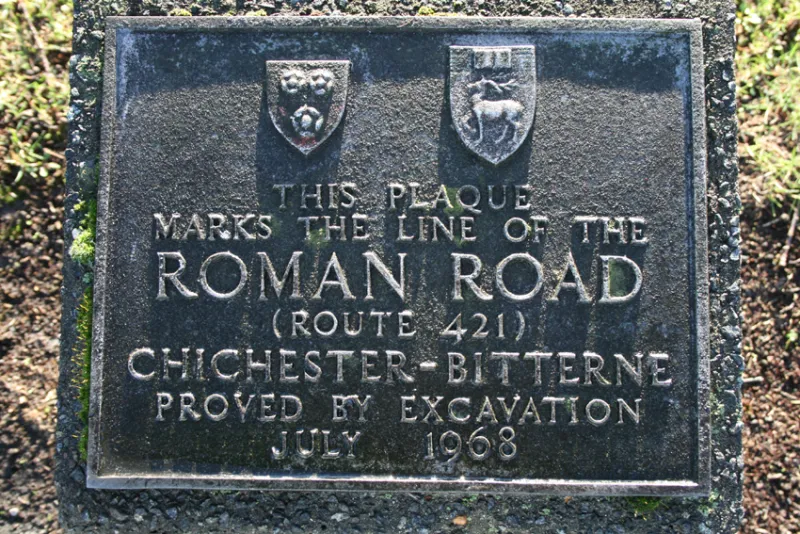
Photo: Murgatroyd49, CC BY-SA 4.0, via Wikimedia Commons
There's a stretch of lane near you — I'd bet good money on it — that somebody down the pub swears blind is Roman. It's straight, it's hedged, it's a bit muddy in February. Case closed, apparently.
Only it usually isn't. Britain's Roman road network was real and remarkable: something in the region of 2,000 miles of engineered highway binding the province together, from the Kent coast to the Wall and out into Wales. But the popular version of that network — every straight B-road a legionary legacy — is a mess of wishful thinking, tourist-board shorthand and one very stubborn myth.
The myth that will not die
The trouble starts with a single word: straight. Roman surveyors did like a good line, and a road running dead straight for miles is genuinely a useful clue. But straightness on its own proves almost nothing. Plenty of Roman roads bend. Plenty of medieval, Georgian and enclosure-era roads are straighter than a die. A field boundary can be arrow-straight because a surveyor with a theodolite drew it in 1795, not because a legionary paced it out in AD 80.
Then there's the related fantasy: that every Roman road is simply buried under an A-road. Sometimes true — the A5 follows Watling Street for long stretches, and the A46 shadows the Fosse Way — but just as often the modern road wanders off, and the Roman line carries on through a field of oilseed rape, unbothered and unmarked.
What actually gives a Roman road away
Archaeologists look at what they call road morphology — the physical shape of the thing. A Roman road in Britain typically has an agger: a raised cambered embankment, often with drainage ditches either side, built up in layers of sand, gravel and stone. Get a section cut through one and you'll see the make-up: a foundation, a metalled surface, sometimes wheel ruts, sometimes a later resurfacing.
That layered build is the giveaway. A farm track is a strip of compacted mud. A Roman road is a piece of civil engineering with a spec.
There's also alignment. Genuine Roman routes tend to run in long, confident bearings, connecting forts, towns and river crossings — sometimes leaping from high ground to high ground in a series of straight legs, then kinking. They serve a purpose. The routes that just happen to be straight and go nowhere in particular usually aren't Roman.
The modern toolkit: LiDAR, cropmarks and a very careful trowel
This is where the last two decades have transformed the picture. LiDAR — laser scanning of the ground surface, much of it now freely available via the Environment Agency — strips away the trees and hedges and shows up faint earthworks that have never made it onto a map. On a good dataset, a Roman agger running across a field looks almost indecently obvious: a long, low ridge with its ditches, cutting across medieval ridge-and-furrow like a ruler laid on corduroy.
Aerial photography adds the rest. In a dry summer, a buried road dries out faster than the soil around it, leaving a pale stripe across a ripening crop. In a wet one, it holds moisture and shows dark. Cropmarks like that, plotted and joined up, have redrawn the map of Roman Britain more than once since the 1970s.
And then, of course, someone has to dig. A small trench across a suspected line will settle in an afternoon what a century of speculation couldn't: ditch profiles, metalling, dating evidence, the lot.
How to read your local map without embarrassing yourself
You don't need a trench to have a sensible go at this. Grab an Ordnance Survey map — Explorer if you've got one — and a LiDAR tile, then look for these combinations rather than any single feature.
Long, confident alignment. A road that runs for three or four kilometres on an identical bearing, then shifts a few degrees and carries on. That kink matters: it often marks a change of surveyor, a new sighting point, or a river crossing.
Continuity of place. Real Roman roads link Roman things. If your straight lane runs between a known Roman fort and a known Roman town, or along a documented line, the odds improve sharply.
The tell-tale suffix. Roads named Street, Stratton, Stretford or Stretton often carry an Old English element meaning exactly that — a paved road, usually Roman. Watling Street, Ermine Street, Akeman Street and Peddars Way are the famous names, but county records and the Victoria County History will give you plenty of minor ones.
Earthworks in the woods. Surviving stretches hide in woodland, where ploughing never got at them. A ride through a wood that's inexplicably banked, cambered and flanked by ditches is worth a look.
Historic Environment Record. Every county has one, and it's free to search. If the HER doesn't list your road as Roman, that's not proof it isn't — but a confident claim from the pub landlord is not a substitute for the record.
The routes that do survive, and the ones that don't
Genuine surviving Roman roads in Britain are patchy and quiet: a stretch of agger in a Hertfordshire field, a hedged lane in the Cotswolds, the odd fragment under turf on the Yorkshire moors. Ermine Street, Dere Street, Stane Street, the Fosse Way and Watling Street are real and traceable, but each has long sections that have been ploughed flat, built over, or quietly re-used as a parish boundary and forgotten.
What doesn't survive, despite the leaflets, is the idea that every village has 'its' Roman road. Local legend is fond of a straight lane and a founding legion. Archaeology is fond of evidence.
So what do you do with that straight B-road?
Enjoy it, by all means — and then check it. Look at the alignment, the earthworks, the HER and the LiDAR. If it holds up, you've found a genuine fragment of a 2,000-year-old infrastructure project, which is a very good afternoon's work. If it doesn't, you've still got a decent walk and a story to gently correct at the pub.
The Romans built a road network that shaped Britain for centuries. They didn't build every straight lane in the country, and the sooner we stop saying they did, the more interesting the real survivors become.